|
KCSE Geography Paper 2 2009 Section B Question 10. (a) (i) Name the towns marked P, Q and R
(ii) Name the minerals that influenced the growth of the towns marked X and Y.
(b) Explain four factors that have led to the growth of Eldoret as a major town in Kenya.
0 Comments
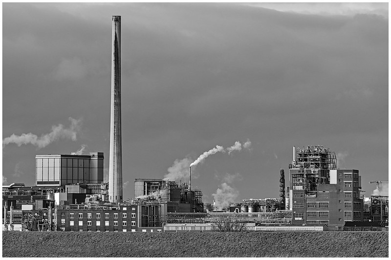
KCSE Geography Paper 2 2009 Section B Question 9. (a) (i) Name three agricultural non- food processing industries in Kenya
(ii) State four ways in which Kenya has benefited from the motor- vehicle Assembly industry
(b) Explain three problems arising from industrialization in Kenya
 KCSE Geography Paper 2 2009 Section B Question 8. (a) (i) What is visible trade?
(ii) List three major imports to Kenya from Japan
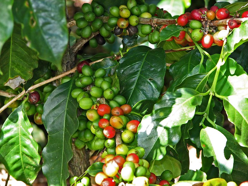
 State three physical conditions that favour coffee growing in the central highlands of Kenya.15/2/2021 KCSE Geography Paper 2 2009 Section B Question 7. (a) State three physical conditions that favour coffee growing in the central highlands of Kenya.
(b) Describe the stages involved in coffee production from picking to marketing
(c) Explain four problems facing coffee farming in Brazil
 KCSE Geography Paper 2 2009 Section B Question 6. The table below shows the number of tourists who visited Kenya from various parts of the world in 2005 and 2006. Use it to answer questions (a) and (b)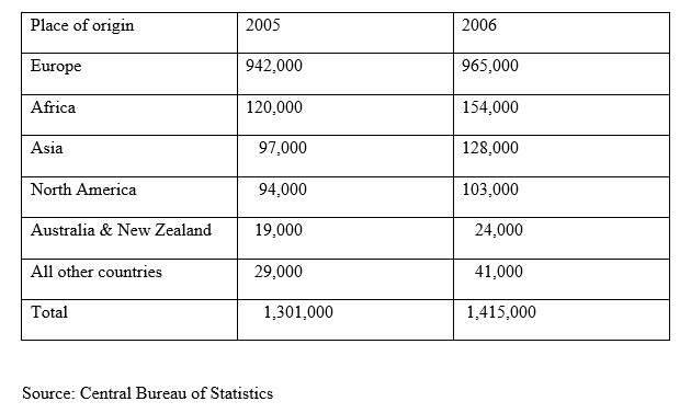 (a) (i) Which continent had the highest increase in the number of tourists visiting Kenya between 2005 and 2006?
(ii) Calculate the percentage increase of tourist from Australia & New Zealand between 2005 and 2006 Apart from windstorms name two other environmental hazards associated with climatic conditions.15/2/2021 KCSE Geography Paper 2 2009 Section A Question 5. (a)Apart from windstorms name two other environmental hazards associated with climatic conditions.
(b)State three problems caused by windstorms in Kenya
 State two ways in which government policy may influence the distribution of human settlement.15/2/2021 KCSE Geography Paper 2 2009 Section A Question 4. Use the sketch map below to answer questions (a)  a)Name the main settlement pattern in
b)State two ways in which government policy may influence the distribution of human settlement.
KCSE Geography Paper 2 2009 Section A Question 3. (a) Outline three physical factors that favoured the development of the Seven Forks hydro- electric power scheme
(b) State two problems facing hydro- electronic power projects in Kenya
 Give three physical conditions that favour maize cultivation in Trans Nzoia District in Kenya15/2/2021 KCSE Geography Paper 2 2009 Section A Question 2. (a) Give three physical conditions that favour maize cultivation in Trans Nzoia District in Kenya
(b)State three reasons facing maize farming in Kenya
 KCSE Geography Paper 2 2009 Section A Question 1. (a) Name two exotic species of tress planted in Kenya
(b) State three reasons why it is necessary to carry out afforestation programmes in Kenya
 The diagram below represents underground features in a limestone area. Use it to answer question (a)15/2/2021 KCSE Geography Paper 1 2009 Section B Question 10. The diagram below represents underground features in a limestone area. Use it to answer question (a)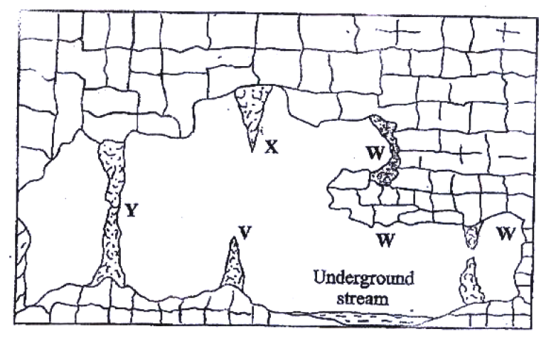 (a) (i) Name the features marked X, V and W
(ii) Describe how the feature marked Y is formed
KCSE Geography Paper 1 2009 Section B Question 9. (a) (i) Apart from Bird’s Foot delta, name two other types of coastal deltas
(ii) Draw a diagram to show a Bird’s foot delta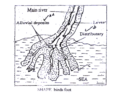 (iii) Describe how a Bird’s Foot delta is formed
KCSE Geography Paper 1 2009 Section B Question 8. (a) (i) Name three types of faults
(ii) Apart from compressional forces, explain two other processes that may cause faulting
 Study the map of Belgut 1: 50, 000 ( Sheet 117/ 3) provided and answer the following questions.15/2/2021 KCSE Geography Paper 1 2009 Section B Question 6. (a) (i) Name the three districts crossed by the all- weather road ( bound surface) in the north – western part of the map extract
(ii)Using the marginal information, give the magnetic variation of the area when the map extract was drawn. (iii)Measure the shortest distance along the loose surface road from the junction at Murumbasi (grid reference 286548) to the school at Chebirbei grid reference 344518). Give your answer in kilometers
KCSE Geography Paper 1 2009 Section B Question 7. The diagram below shows a hydrological cycle.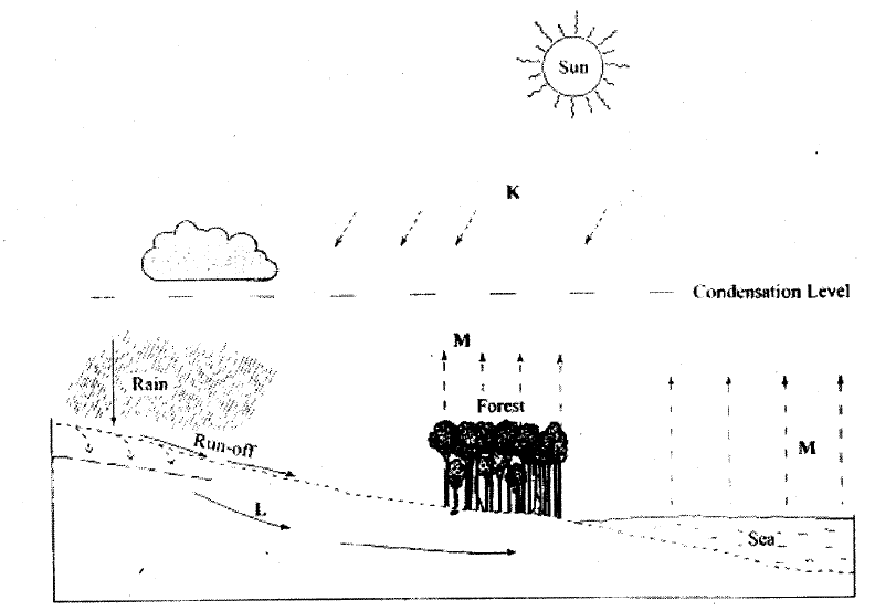 (a) (i) What do the arrows labeled K, L, and M on the cycle represent?
(ii) Explain three factors that influence the occurrence of surface run- off
(b) (i) What is mass wasting?
KCSE Geography Paper 1 2009 Section A Question 5. The diagram below shows some types of folds. Use it to answer question (a)  (a) Name the type of folds marked E, F, and G
(b) In which countries are the following fold mountains found?
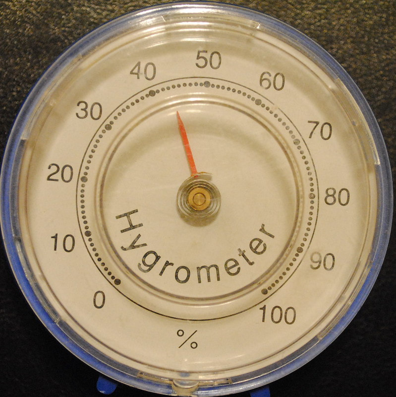
KCSE Geography Paper 1 2009 Section A Question 4. (a) Outline the steps followed when measuring humidity using a hygrometer
(b) Give two factors that influence relative humidity
 KCSE Geography Paper 1 2009 Section A Question 3. (a) What is a line of longitude?
(b) What is the local time at Alexandra 30°E when the local time at Malindi 40°E is 12.00 noon?
 KCSE Geography Paper 1 2009 Section A Question 2. Use the diagram below to answer the questions that follows 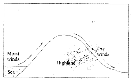 Outline the process though which the moist winds shown go through to eventually become dry winds
KCSE Geography Paper 1 2009 Section A Question 1. (a) Differentiate between the processes of the formation of plutonic rocks and volcanic rocks
(b) For each of the following sedimentary rocks, name the resultant rock that forms after metamorphism:
 |

Archives
March 2024
Categories
All
|
 RSS Feed