Name two forces responsible for the geoid shape of the earthName two forces responsible for the geoid shape of the earth. (2mks)
The geoid shape of the Earth is determined by two forces: centripetal force and centrifugal force. Let me explain further:
Give three reasons why the interior of the earth is very hot. (3mks)
The interior of the Earth is very hot due to several reasons. Here are three reasons why:
0 Comments
Name the types of earth movements that occur within the earth’s crust.
Give three proofs that the earth is almost spherical in shape.
State three effects of the revolution of the earth
State three causes of earth movements. (3marks)
Name two types of earth movements. (2 marks)
State three storage processes of water on the earth surface. (3mks)
The diagram below shows the internal structure of the earth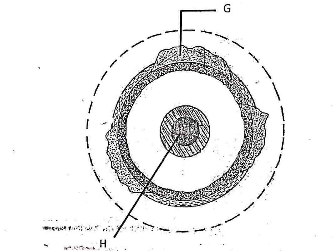 Name the parts marked G and H. (2mks)
Describe how a solar eclipse occurs (4 marks)
State the characteristics of the earth’s core. (5 marks)
Explain two reasons for the shape of the earth. (4 marks)
The diagram below represents the occurrence of an earthquake in the crust. Name the parts marked A, B, and C. (3 marks)
Explain how the revolution of the earth causes seasons. (8 marks)
Define the term earthquake. (2 marks)
An earthquake refers to a sudden and rapid movement of the earth’s crust. OR An earthquake refers to violent shaking of the ground due to sudden release of energy from below. Apart from the movement of tectonic plates, state three other natural causes of earthquakes30/6/2023 Apart from the movement of tectonic plates, state three other natural causes of earthquakes. (3 marks)
Explain two ways in which the movement of tectonic plates causes earthquakes. (4 marks)
KCSE Geography Paper 1 2001 Section A Question 1. (a) (i) Give the two dates in a year during which the number of hours of darkness is equal in both the north and south poles.
(ii) Why do the lengths of days and nights vary from one part of the earth to another?
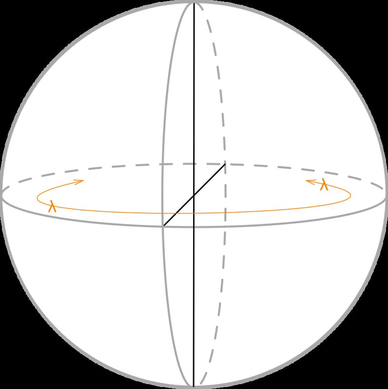
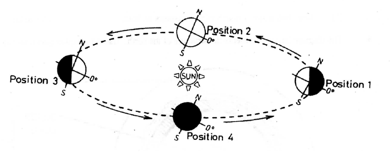
(b) The diagram below shows the revolution of the earth around the sun. Use it to answer the questions that follow  KCSE Geography Paper 1 2002 Section A Question 5. a) What is the solar system?
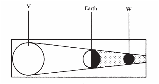
b) Use the diagram below to answer the questions that follow.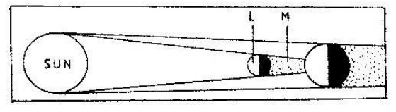 i) What type of eclipse is represented by the diagram?
ii) Name the features marked L and M
KCSE Geography Paper 1 2004 Section A Question 2. a) What is latitude?
b) What is the time at Hola on 40°E when the time at Tema on 0° longitude is 12.00 noon?
 KCSE Geography Paper 1 2005 Section A Question 1. (a) Name two theories of the origin of the earth
(b) Name four layers of the earth’s atmosphere
 KCSE Geography Paper 1 2006 Section A Question 3. The diagram below shows the composition of the solar system  (a) Name the planets marked F and G
(b) State three effects of the rotation of the earth on its axis
KCSE Geography Paper 1 2007 Section A Question 4. The diagram below represents the structure of the earth. Use it to answer question 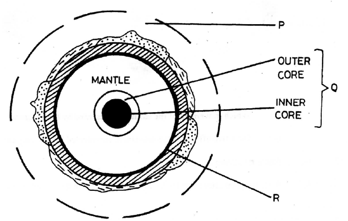 (a) Name |

Archives
March 2024
Categories
All
|
 RSS Feed