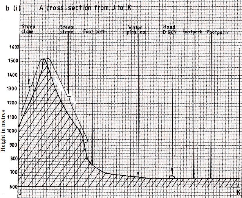
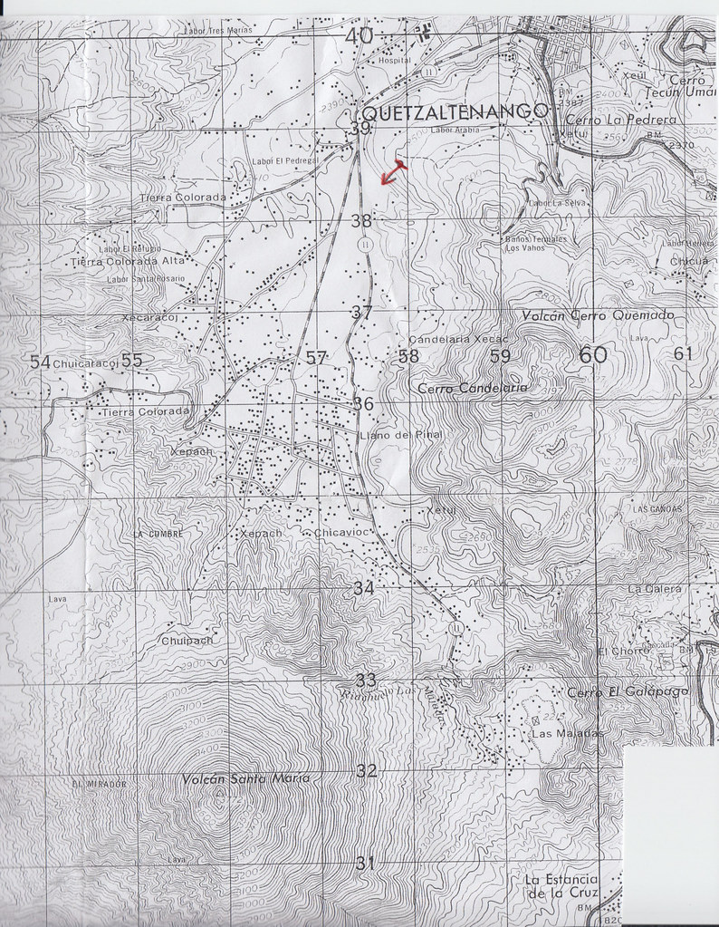
KCSE Geography Paper 1 2000 Section b Question 6 with Answers.Study the map of Mathioya 1: 50,000 provided and answer the following questions(a) (i) What is the bearing of the cattle dip at grid reference 716386 form the coffee factory at grid reference 740377?
(i) - 290 degrees
(ii) Give the approximate height of Kigoini dam
(ii) - 1000m above sea level
(iii) Measure the length of the district boundary in the Aberdare forest from Western margin of the map to the eastern edge of the forest (Give your answer in kilometers)
(iii) - 12.3 km or 12.2 km or 12.4 km
(b) Describe the drainage of the area covered by the map
0 Comments
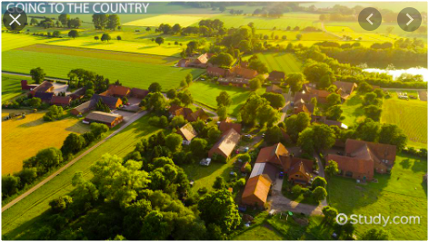
KCSE Geography Paper 2 2004 Section B Question 9. a) i) Name two types of rural settlement patterns.
ii) A part from urban-rural migration. Name two other types of migration.
 KCSE Geography Paper 2 2005 Section A Question 1. (a) Name the two types of human settlements
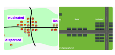
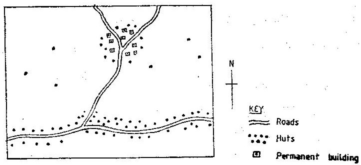
Use the sketch map below to answer questions (b)  (b) Identify the settlement pattern marked Q and R
State two ways in which government policy may influence the distribution of human settlement.15/2/2021 KCSE Geography Paper 2 2009 Section A Question 4. Use the sketch map below to answer questions (a)  a)Name the main settlement pattern in
b)State two ways in which government policy may influence the distribution of human settlement.
KCSE Geography Paper 2 2011 Section B Question 10. (a) Differentiate between a rural settlement and an urban centre.
(b) Explain how the following physical factors influence human settlement: (i) Relief.
 KCSE Geography Paper 2 2012 Section B Question 10. (a) (i) Name two settlement patterns.
(ii) Explain four physical factors that influence settlement.
 KCSE Geography Paper 2 2013 Section A Question 4. (a)State two factors that lead to the development of nucleated settlement patterns.
(b)Identify two differences in the functions of Nairobi and New York.Nairobi New York
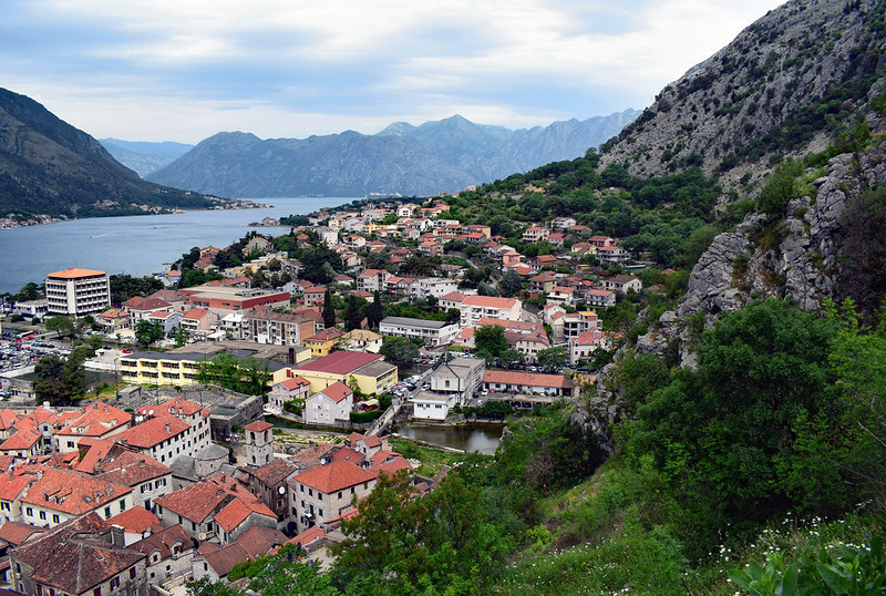
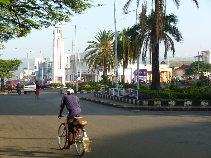
 KCSE Geography Paper 2 2014 Section B Question 6. Study the photograph below and use it to answer question (a)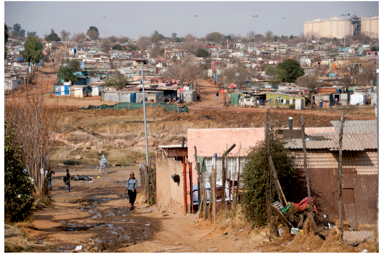 (a) (i) Identify the type of photograph shown above.
(ii) Name the type of settlement shown on the photograph.
KCSE Geography Paper 1 2014 Section B Question 6. Study the map of Migwani 1:50,000 (sheet 151/1) provided and answer the following questions. |

Archives
March 2024
Categories
All
|


 RSS Feed