|
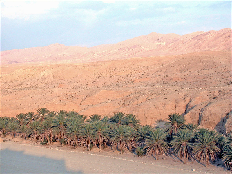
KCSE Geography Paper 1 2002 Section A Question 3. a) What is desertification?
b) State two negative effects of desertification.
0 Comments
KCSE Geography Paper 1 2002 Section A Question 2. Use the diagram below to answer question (a) 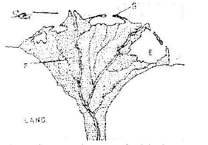 a) i) What type of a delta is represented by the diagram?
ii) Name the features marked E,F, and G.
b) State two conditions necessary for the formation of a delta.
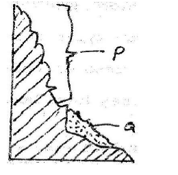
The diagram below represents features produced by faulting.Use it to answer questions that follow.26/2/2021 KCSE Geography Paper 1 2002 Section A Question 1. The diagram below represents features produced by faulting. Use it to answer questions that follow.  a) Name the features marked P,Q, and R
b) Differentiate between a normal faulty and a reverse fault.
KCSE Geography Paper 2 2003 Section B Question 9. Use the map of North America (in question paper) to answer question (a) 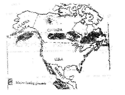 a)i) Name two methods of fishing used in the shaded areas,
ii) Name two types of fish caught along the west coast of Canada
KCSE Geography Paper 2 2003 Section B Question 8. a) Name three agricultural non food manufacturing industries in Kenya.
b)i) Draw outline map of Kenya (map should have a frame / outline correct).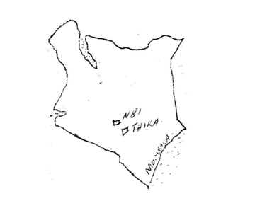 ii) On the outline map, mark and name two towns where motor vehicles are assembled.
KCSE Geography Paper 2 2003 Section B Question 7. a) i) Give two primary sources of population on data.
ii) What information can be derived from a population pyramid?
b) Describe three ways in which the population of Kenya differs from that of Sweden.
 The table below shows the value of Kenyans imports and exports in 1999.Use it to answer questions(a)26/2/2021 KCSE Geography Paper 2 2003 Section B Question 6. The table below shows the value of Kenyans imports and exports in 1999.Use it to answer questions(a) 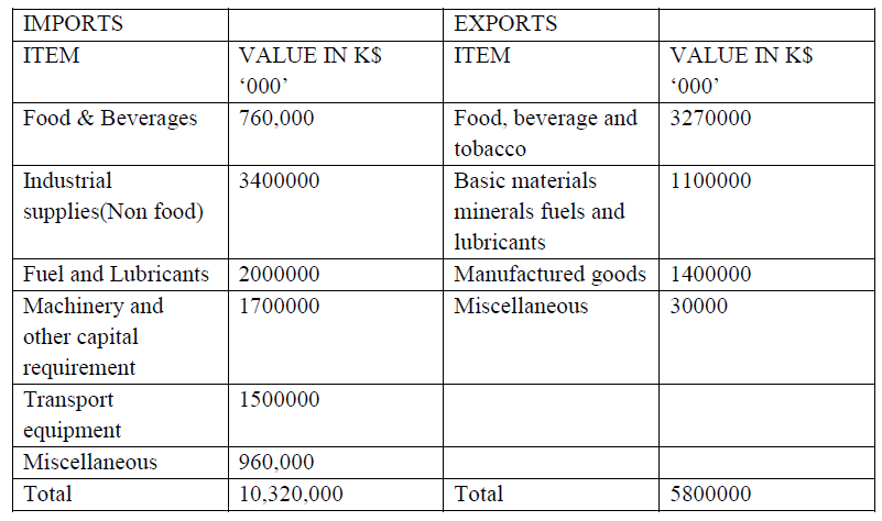 a) Use a radius of 5cm, draw a pie chart to represent data on exports shown on the table above. Show your calculations.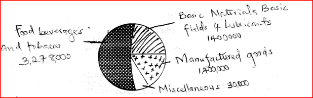 KCSE Geography Paper 2 2003 Section A Question 5. a) State three reasons why National parks have been established in Kenya.
b) A part from marine parks, give two other tourist attractions found at the coast of Kenya.
 KCSE Geography Paper 2 2003 Section A Question 4. a) Why is it necessary to conserve water?
b) How does terracing help in water conservation?
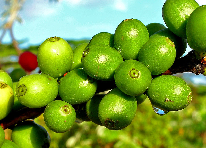
 KCSE Geography Paper 2 2003 Section A Question 3. a) Give three physical factors that favour coffee growing in Kenya highlands.
b) State two problems facing coffee farming in Kenya
 KCSE Geography Paper 2 2003 Section A Question 2. a) A part from draining swamps, state two other methods used in reclaiming land in Kenya.
b) State three benefits that resulted from reclamation of the Yata swamp
 KCSE Geography Paper 2 2003 Section A Question 1. a) What is urbanization?
b) Give two differences in the function of New York and Nairobi cities. New York Nairobi
 KCSE Geography Paper 1 2003 Section B Question 9. a)(i)Two process through which wind erodes the surface
(ii) Three ways through which wind transports its loadSuspension
b)(i)How an oasis is forced
 KCSE Geography Paper 1 2000 Section B Question 9 with Answers.(a) (i) Describe how lake Victoria was formed
Warping of land during volcanic activities in the rift valley
(ii) Explain how Lake Victoria has modified the climate of the surrounding
KCSE Geography Paper 1 2000 Section B Question 8 with Answers.(a) State three characteristics of the inter-tropical convergence zone
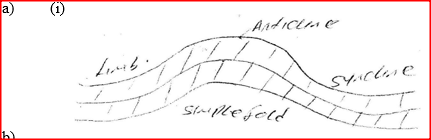
(b) With the aid of a labeled diagram, describe how relief rainfall is formed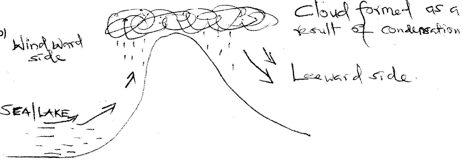
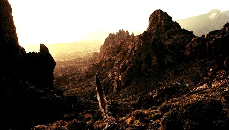
Diagram` ½ mk each max -2 KCSE Geography Paper 1 2000 Section B Question 7 with Answers.(a) Differentiate between plutonic rocks and volcanic rocks
Volcanic rocks
Plutonic rocks
KCSE Geography Paper 1 2003 Section B Question 8. The tables below represent rainfall and temperature of stations X and Y. Use them to answer questions (a) and (b) 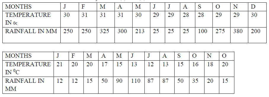 a) (i) for each of the two stations calculate the mean annual temperature.
KCSE Geography Paper 1 2000 Section b Question 6 with Answers.Study the map of Mathioya 1: 50,000 provided and answer the following questions(a) (i) What is the bearing of the cattle dip at grid reference 716386 form the coffee factory at grid reference 740377?
(i) - 290 degrees
(ii) Give the approximate height of Kigoini dam
(ii) - 1000m above sea level
(iii) Measure the length of the district boundary in the Aberdare forest from Western margin of the map to the eastern edge of the forest (Give your answer in kilometers)
(iii) - 12.3 km or 12.2 km or 12.4 km
(b) Describe the drainage of the area covered by the map
KCSE Geography Paper 1 2003 Section B Question 7. a) (i) What is a glacier?
(ii) Distinguish between valley glaciers and ice sheets
b) The diagram (in the question paper) represents an upland glaciated landscape. Use it to answer question b (i) and (ii) Study the map of Menu (1: 50,000, sheet 108/3) provided and answer the following questions24/2/2021 KCSE Geography Paper 1 2003 Section B Question 6. Study the map of Menu (1: 50,000, sheet 108/3) provided and answer the following questions |

Archives
March 2024
Categories
All
|
 RSS Feed